Each year, the US Geological Survey (USGS) monitors salt marsh elevation in Morro Bay. Staff from the Estuary Program joined USGS this year’s to lend a hand. The goal of this project is to track changes in salt marsh elevation relative to sea level rise.
What is a Salt Marsh?
Morro Bay is home to a variety of key habitats that are essential for a healthy ecosystem. One of the most important habitats is the salt marsh, which acts as the transition zone between fresh and saltwater environments. This unique area provides food and refuge for many species and can help protect coastlines from erosion and sea level rise.
A Changing Marsh
Salt marshes are naturally dynamic ecosystems. Each day, the marsh floods and drains with the tides. Depending on the height of the tides, some sections of the marsh may flood completely, while others may only flood a handful of times per year.
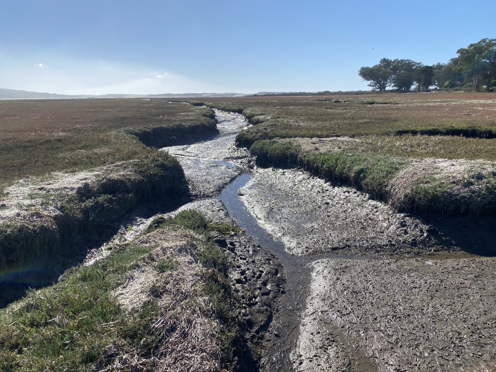
The marsh is also influenced by two freshwater streams, Chorro Creek and Los Osos Creek. During large rainstorms, these creeks can carry sediment and nutrient runoff downstream. The marsh can act as a sponge as it slows the rushing waters and allows fine sediment to be deposited there before the water continues on to the bay.
The Effect of a Changing Climate
Climate change poses a threat to tidal wetlands across the globe. It is estimated that nearly half of tidal marshes in the contiguous United States may be at risk due to climate change and sea level rise. The resiliency of these wetlands is largely based on whether the marsh can capture sediment and grow vertically to keep up with the pace of sea level rise.
Measuring Marsh Elevation
USGS has monitored salt marsh elevation in Morro Bay for nearly a decade using two primary methods: a surface elevation table (SET) and feldspar marker horizons. These methods are precise, non-destructive, and used worldwide.
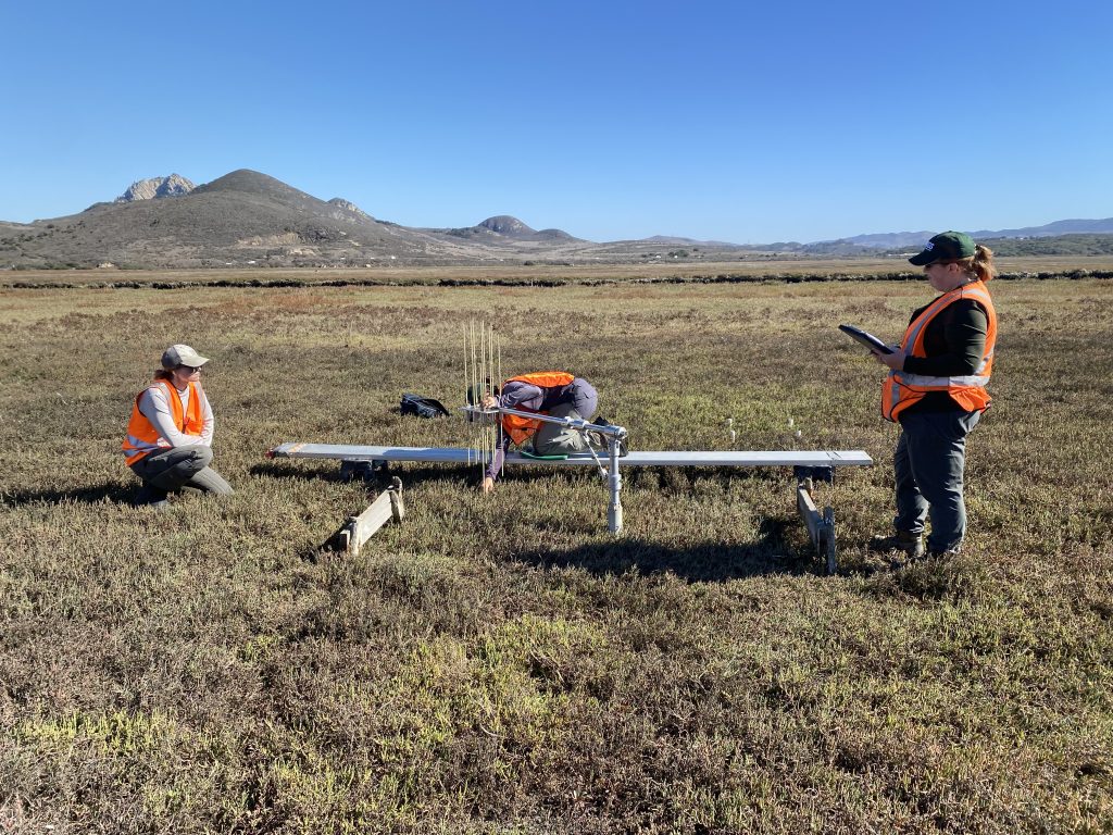
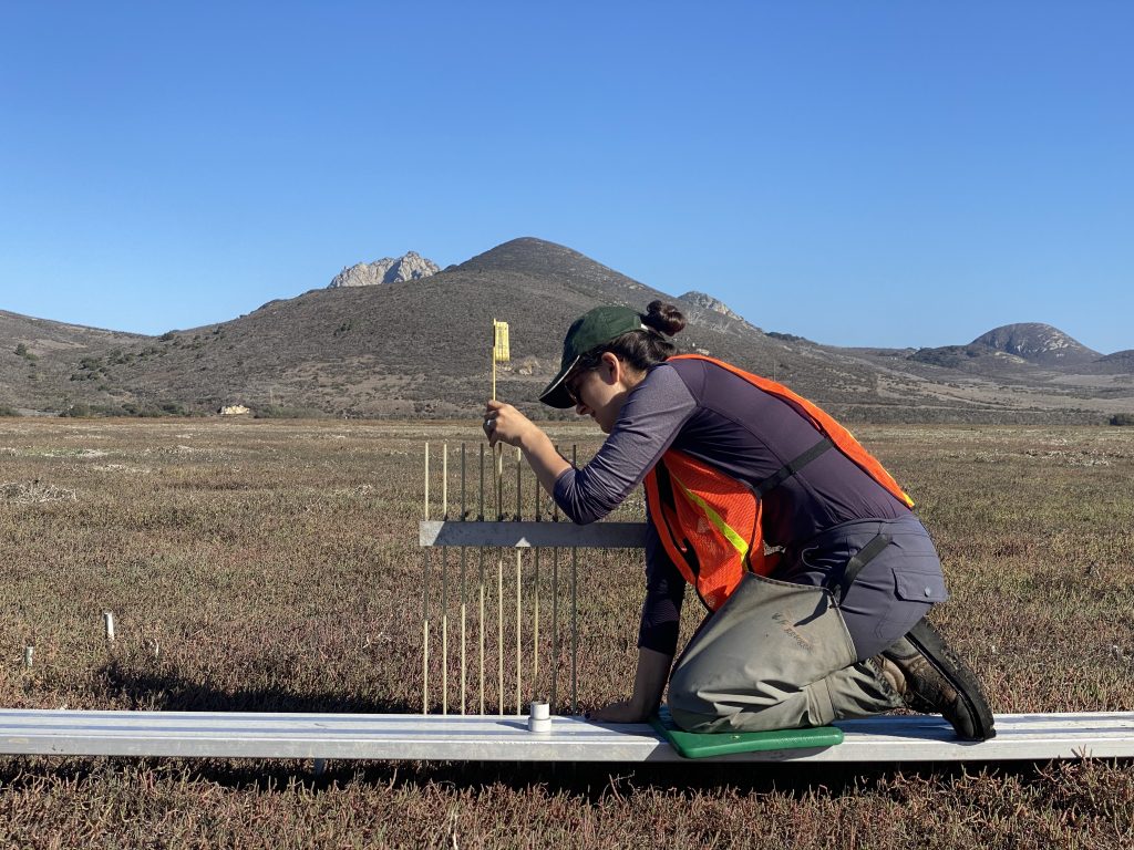
Surface Elevation Tables (SETs)
A surface elevation table, or SET, is a mechanical leveling device for measuring changes in elevation of the wetland surface. The SET consists of a long metal rod that is permanently stationed at each site. Staff bring with them a leveled mechanical arm with nine individual pins. Elevation measurements are taken from the top of each of the nine pins. All measurements can be compared to readings taken at the beginning of the study to determine the overall change in marsh elevation.
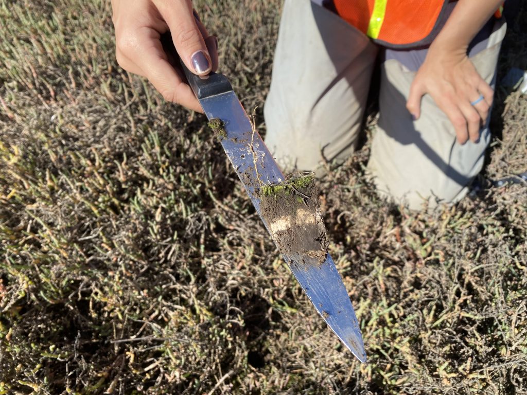
Feldspar Marker Horizons
Feldspar marker horizons measure how much sediment has deposited in a particular location. Marker horizons are installed by adding a thick layer of white feldspar clay in a square plot. Surveyors return to the plot to measure how much sediment deposited on top of the white clay layer.
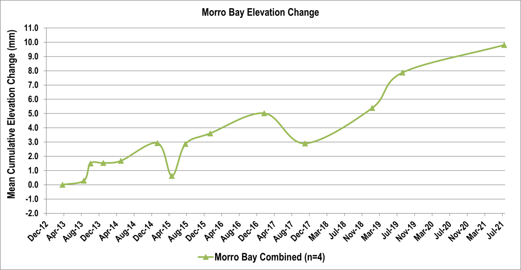
Changes in Morro Bay Marsh Elevation
USGS has collected sediment elevation data in Morro Bay with SETs and feldspar marker horizons since 2013. The average cumulative elevation change since the sites were established is +8.84 mm, indicating that the salt marsh is increasing in elevation.
The Threat of Sea Level Rise
While the elevation of the Morro Bay salt marsh is currently keeping pace with rising seas, the predicted acceleration of sea level rise threatens salt marshes and other coastal areas around the globe. The Estuary Program and its many partners, including USGS and NOAA, continue to monitor, model, and study these changes while developing projects to help protect these vulnerable areas.
For more information on sea level rise, you can visit https://climate.nasa.gov/vital-signs/sea-level/.
Help us protect and restore the Morro Bay estuary!
- Donate to the Estuary Program today and support our work in the field, the lab, and beyond. The Estuary Program is a 501(c)3 nonprofit. We depend on funding from grants and generous donors to continue our work.
- Support us by purchasing estuary-themed gear from ESTERO. This locally owned and operated company donates 20% of proceeds from its Estuary clothing line and 100% of Estuary decal proceeds to the Estuary Program. Thank you, ESTERO!
- Purchase items from the Estuary Program’s store on Zazzle. Zazzle prints and ships your items, and the Estuary Program receives 10% of the proceeds.
Thank you for helping our beautiful, bountiful, biodiverse bay!