November was a busy month for our field staff.
Mapping eelgrass and algae
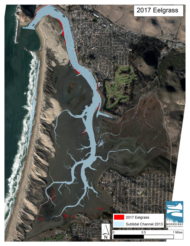
The Estuary Program has been mapping submerged vegetation, such as eelgrass and algae, for more than fifteen years. This is done by having a plane fly over the bay taking a series of images, including a multispectral image. We try to repeat this survey about every other year, with 2019 being an eelgrass flight year.
Multispectral imagery
Multispectral imagery is produced by sensors that measure the reflected energy within several bands of the electromagnetic signature, usually capturing light not visible to our eyes. You can classify the photos based on the signature of the vegetation in the image. This allows us to produce a map of the distribution of eelgrass and other vegetation in and around the bay, such as algae and saltmarsh plants. From this map, we can pull out just the eelgrass to determine the current acreage. In 2017, the flight captured a little more than thirteen acres of eelgrass. We are hoping to see an increase in that number this year.

Groundtruthing and wildlife in the eelgrass
Groundtruthing is an importing component of this data collection. For groundtruthing, staff goes out with a highly accurate GPS unit to different parts of the bay and takes GPS points where different vegetation types (green algae, eelgrass etc) are located. This will help validate the data collected in the aerial image.
Low tides are the easiest time to conduct these surveys. In the fall, the good low tides are in the afternoons. In addition to collecting data, this time is great not only for seeing spectacular sunsets, but also for observing marine organisms on the mudflat.
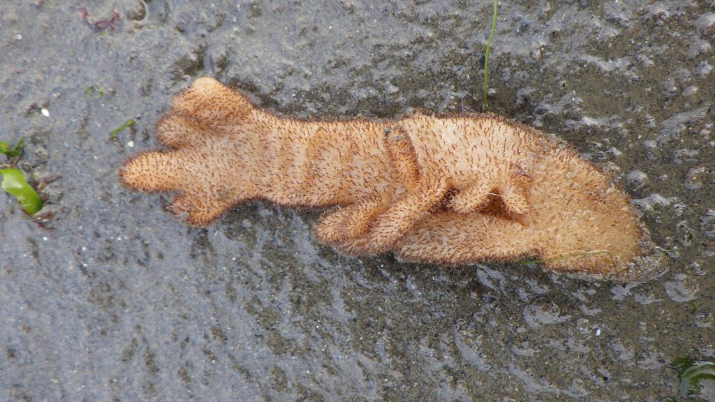
We found this washed up along the sandspit. We think it is a member of the Bryozoan phylum, likely in the genus Flustrellidra.

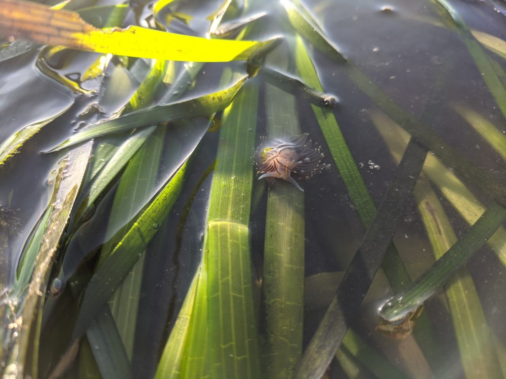
We also saw a few opalescent nudibranchs (Hermissenda opalescens) hiding in eelgrass patches.

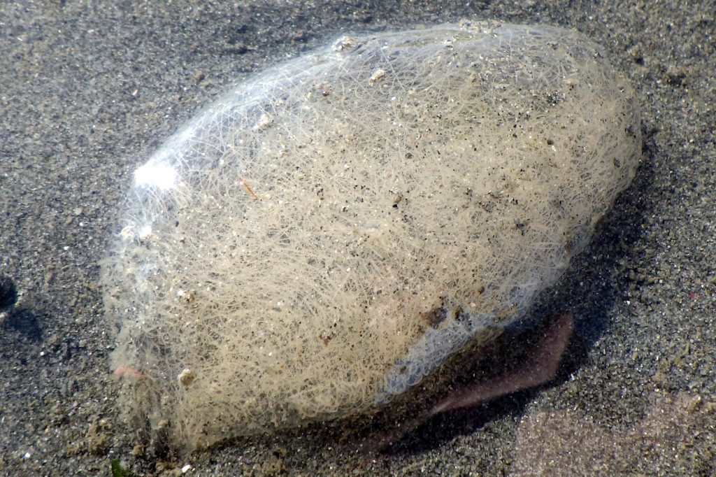
Though we haven’t seen too many adult navanax, we are seeing a lot of what we think are navanax egg masses.

In addition to mapping out the vegetation extent in the estuary, we also got out there in the mud to monitor and check on the eelgrass patches in person! This fall was the last round of monitoring for a multi-year study on eelgrass that the Estuary Program was fortunate to assist with. This was done by counting the number of eelgrass shoots within a predetermined plot that was revisited each season (fall, summer, spring, and winter). It’s exciting to wrap up this phase and use the data to get a more complete picture of the eelgrass condition over the past few years.
Weather!
Some rain finally crept into the watershed in the last few days of November. The SLO County rain gauge at Canet Road measured 2.22″ of rain between November 26th and November 30th. This was the first splash of rain since May! It looks like it’s going to be a wet weekend as well but then clear skies for near future.
Thank you, as always, for being interested in the activities here at the Estuary Program, especially those out in the field. Keep a look out next month for another Field Updates post.
Help us protect and restore the Morro Bay estuary
- Donate to the Estuary Program today and support our work in the field, the lab, and beyond.
The Estuary Program is a 501(c)3 nonprofit. We depend on funding from grants and generous donors to continue our work. - Support us by purchasing estuary-themed gear from ESTERO. This locally owned and operated company donates 20% of proceeds from its Estuary clothing line and 100% of Estuary decal proceeds to the Estuary Program. Thank you, ESTERO!
- Purchase items from the the Estuary Program’s store on Zazzle. Zazzle prints and ships your items, and the Estuary Program receives 10% of the proceeds. Choose from mugs, hats, t-shirts, and even fanny packs (they’re back!) with our fun Estuary Octopus design, our classic Estuary Program logo, or our Mutts for the Bay logo.
Thank you for your support!